Start of Main Content
Notice
Water level now stabilized & rising: Erie Canal between Locks E25-E26.
08/01/2017 04:39 PM
Notice to Mariners
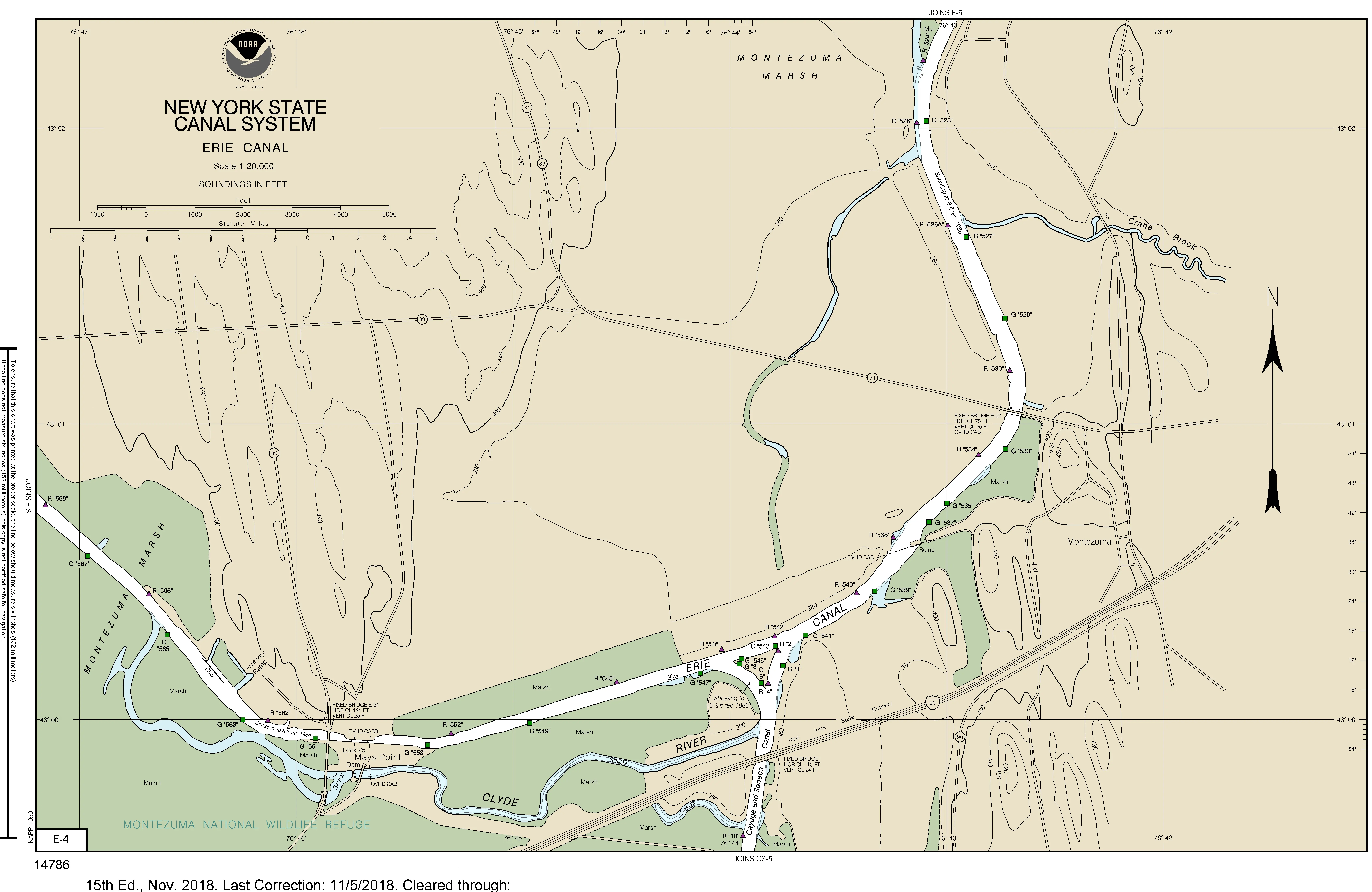
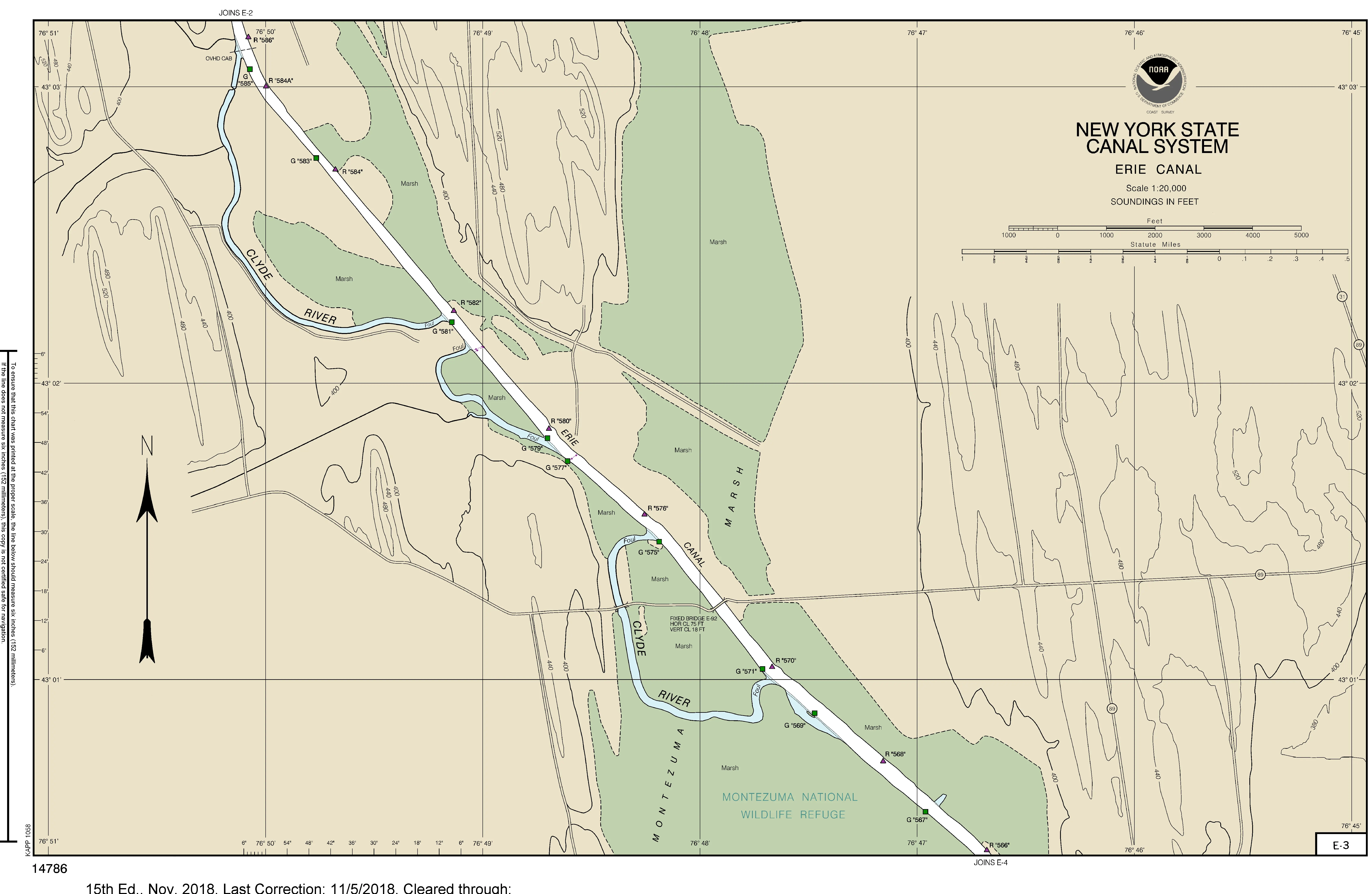
Erie Canal – Mays Point to Clyde
August 1, 2017
Mariners are advised that the water surface level between Erie Canal Locks E-25 Mays Point and E-26 Clyde has stabilized and should slowly be returning to normal over the course of the evening.
Charts 14786 E-4, E-3, and E-2 covering the affected area can be found at 14786e04.webp, 14786e03.webp, and 14786e02.webp.
Features along the Western Erie Canal are listed by mileage at /Navigation-Information.
For updates and information, please visit Canals.NY.gov or follow us on Facebook or Twitter