Start of Main Content
Notice
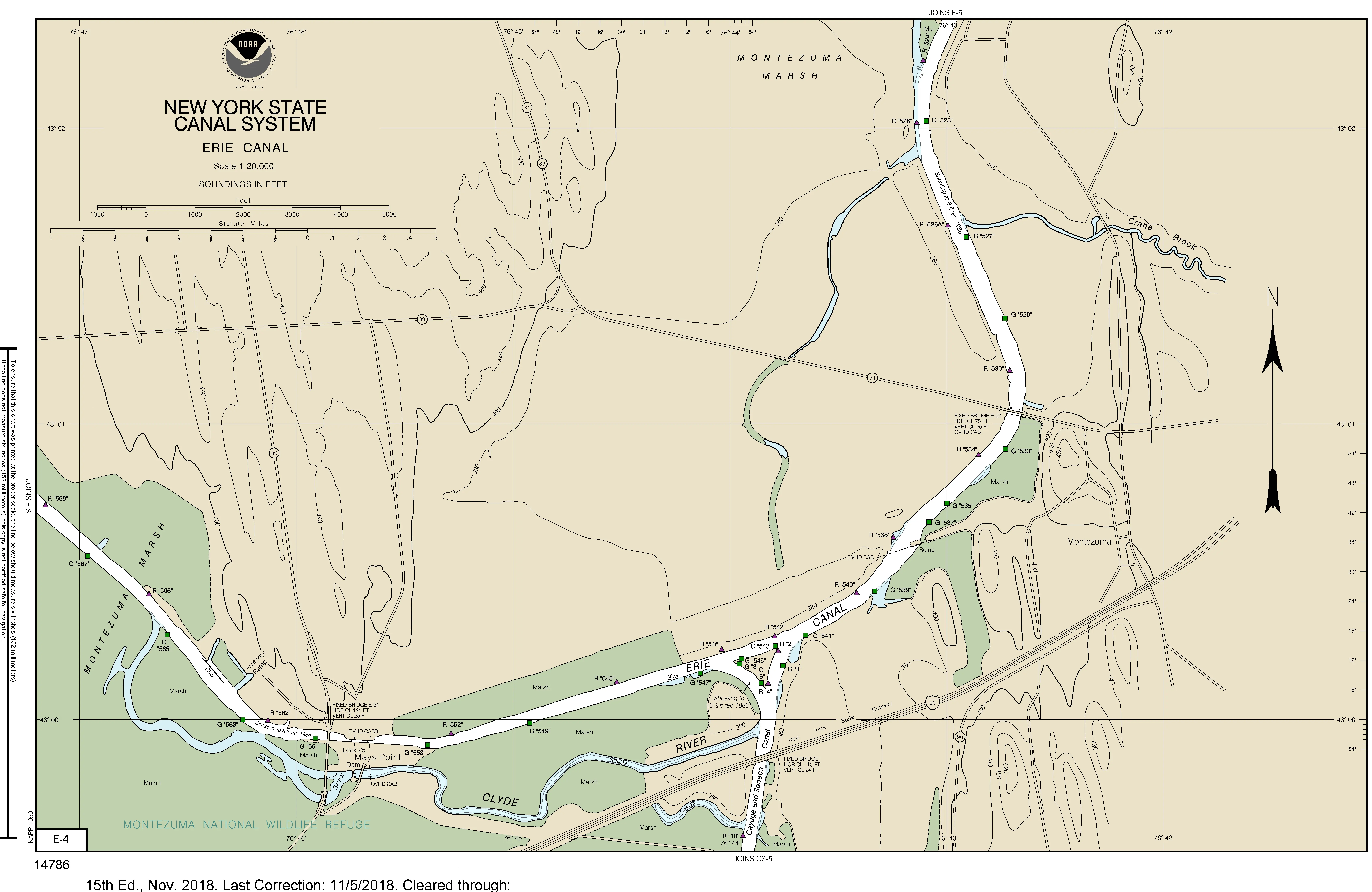
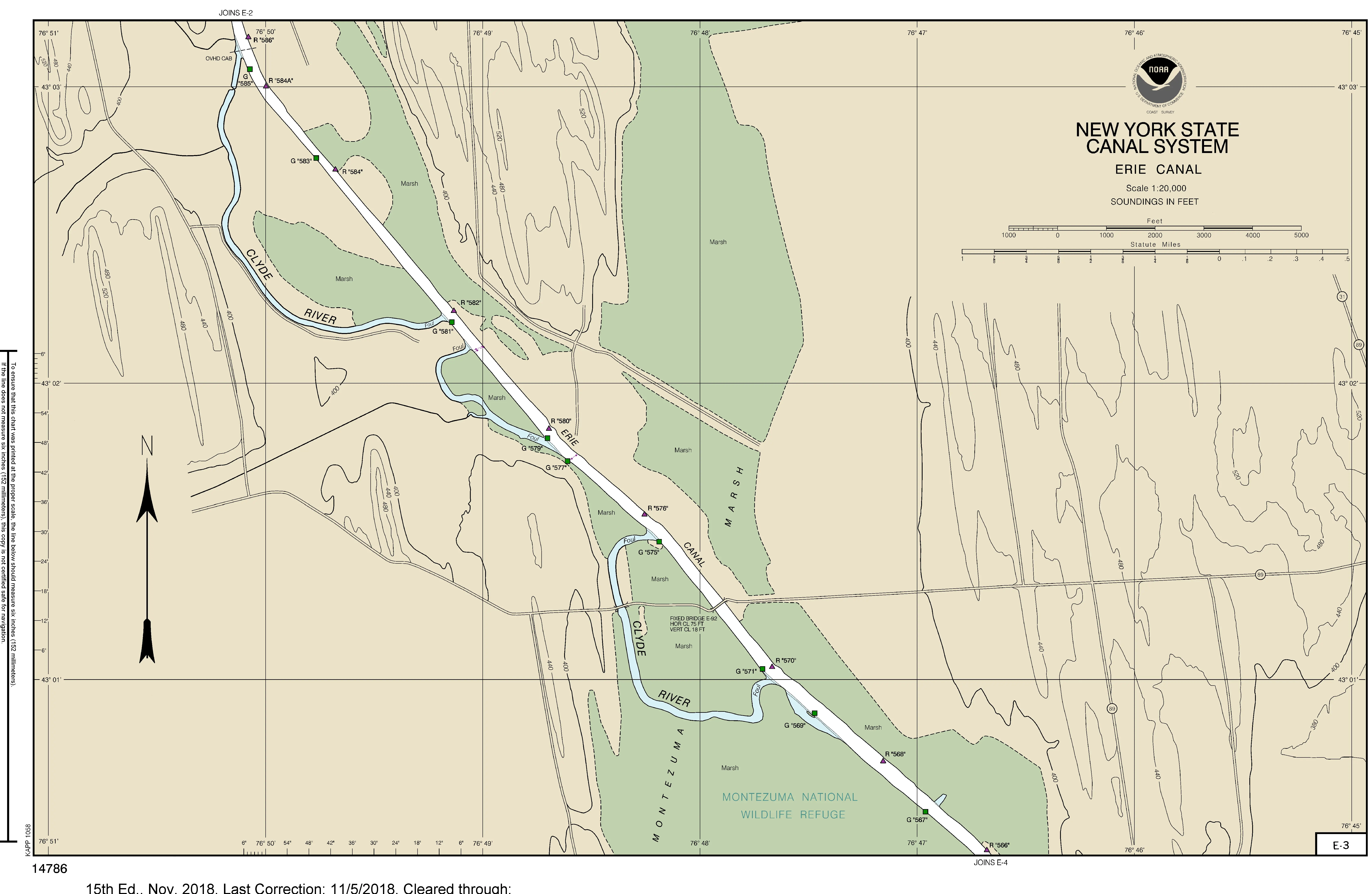
Reduced depth: Erie Canal between Lock E25 Mays Point & E26 Clyde.
08/01/2017 01:32 PM
Notice to Mariners
Erie Canal – Mays Point to Clyde
August 1, 2017
Mariners are advised that the water surface level between Erie Canal Locks E-25 Mays Point and E-26 Clyde is near its lower operating threshold and will likely drop below it within the next day.
Captains of larger, deeper draft vessels planning on transiting this reach of the canal within the next 24 hours are to contact the Navigation Program Manager at (518) 461-0942.
Charts 14786 E-4, E-3, and E-2 covering the affected area can be found at 14786e04.webp, 14786e03.webp, and 14786e02.webp.
Features along the Western Erie Canal are listed by mileage at /Navigation-Information.
For updates and information, please visit Canals.NY.gov or follow us on Facebook or Twitter